Tropical Storm Warning
Elsa Local Watch/Warning Statement/Advisory Number 33
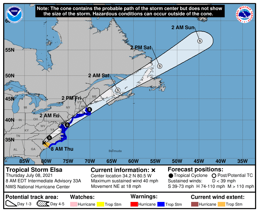
National Weather Service Boston/Norton MA AL052021
457 AM EDT Thu Jul 8 2021
Barnstable MA-
457 AM EDT Thu Jul 8 2021
…TROPICAL STORM WARNING IN EFFECT…
A Tropical Storm Warning means tropical storm-force winds are
expected somewhere within this area within the next 36 hours
* LOCATIONS AFFECTED
– Chatham
– Falmouth
– Provincetown
* WIND
– LATEST LOCAL FORECAST: Tropical storm force winds remain
possible
– Peak Wind Forecast: 25-35 mph with gusts to 45 mph
– THREAT TO LIFE AND PROPERTY THAT INCLUDES TYPICAL FORECAST
UNCERTAINTY IN TRACK, SIZE AND INTENSITY: Potential for wind 58
to 73 mph
– The wind threat has increased from the previous assessment.
– PLAN: Plan for dangerous wind of equivalent strong tropical
storm force.
– PREPARE: Efforts to protect life and property should now be
underway. Prepare for significant wind damage.
– ACT: Act now to complete preparations before the wind
becomes hazardous.
– POTENTIAL IMPACTS: Significant
– Some damage to roofing and siding materials, along with
damage to porches, awnings, carports, and sheds. A few
buildings experiencing window, door, and garage door
failures. Mobile homes damaged, especially if unanchored.
Unsecured lightweight objects become dangerous projectiles.
– Several large trees snapped or uprooted, but with greater
numbers in places where trees are shallow rooted. Several
fences and roadway signs blown over.
– Some roads impassable from large debris, and more within
urban or heavily wooded places. A few bridges, causeways,
and access routes impassable.
– Scattered power and communications outages, but more
prevalent in areas with above ground lines.
* STORM SURGE
– No storm surge inundation forecast
– THREAT TO LIFE AND PROPERTY THAT INCLUDES TYPICAL FORECAST
UNCERTAINTY IN TRACK, SIZE AND INTENSITY: Little to no storm
surge flooding
– The storm surge threat has remained nearly steady from the
previous assessment.
– PLAN: There is little to no threat of storm surge flooding.
Rough surf, coastal erosion, and life-threatening rip
currents are possible.
– PREPARE: Little to no preparations for storm surge flooding
are needed.
– ACT: Follow the instructions of local officials. Monitor
forecasts.
– POTENTIAL IMPACTS: Little to None
– Little to no potential impacts from storm surge flooding.
* FLOODING RAIN
– LATEST LOCAL FORECAST:
– Peak Rainfall Amounts: Additional around 1 inch
– THREAT TO LIFE AND PROPERTY THAT INCLUDES TYPICAL FORECAST
UNCERTAINTY IN TRACK, SIZE AND INTENSITY: Potential for
localized flooding rain
– The flooding rain threat has remained nearly steady from
the previous assessment.
– PLAN: Emergency plans should include the potential for
localized flooding from heavy rain.
– PREPARE: Consider protective actions if you are in an area
vulnerable to flooding.
– ACT: Heed any flood watches and warnings.
– POTENTIAL IMPACTS: Limited
– Localized rainfall flooding may prompt a few evacuations.
– Rivers and tributaries may quickly rise with swifter
currents. Small streams, creeks, and ditches may become
swollen and overflow in spots.
– Flood waters can enter a few structures, especially in
usually vulnerable spots. A few places where rapid ponding
of water occurs at underpasses, low-lying spots, and poor
drainage areas. Several storm drains and retention ponds
become near-full and begin to overflow. Some brief road and
bridge closures.
* TORNADO
– LATEST LOCAL FORECAST:
– Situation is somewhat favorable for tornadoes
– THREAT TO LIFE AND PROPERTY THAT INCLUDES TYPICAL FORECAST
UNCERTAINTY IN TRACK, SIZE AND INTENSITY: Potential for a few
tornadoes
– The tornado threat has increased from the previous
assessment.
– PLAN: Emergency plans should include the potential for a
few tornadoes.
– PREPARE: If your shelter is particularly vulnerable to
tornadoes, prepare to relocate to safe shelter before
hazardous weather arrives.
– ACT: If a tornado warning is issued, be ready to shelter
quickly.
– POTENTIAL IMPACTS: Limited
– The occurrence of isolated tornadoes can hinder the
execution of emergency plans during tropical events.
– A few places may experience tornado damage, along with
power and communications disruptions.
– Locations could realize roofs peeled off buildings,
chimneys toppled, mobile homes pushed off foundations or
overturned, large tree tops and branches snapped off,
shallow-rooted trees knocked over, moving vehicles blown
off roads, and small boats pulled from moorings.
* FOR MORE INFORMATION:
– https://www.weather.gov/box