 NANTUCKET – They may not be completely up-to-date, but they sell for $200 apiece.
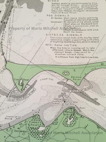
Around 75 to 100 maps, dating back to 1945, have been found tucked away in the corner of a room at the former Maria Mitchell Library.
The marine-themed antiquities detail Nantucket Harbor and feature a “useful information” section for sailors, highlighting “winds, fog signals, distress signals” and more.
According to Deputy Director of the Nantucket Maria Mitchell Association Jascin Leonardo Finger, the maps were draught by landscape architect R. Newton Mayall, whose wife Margaret worked for the association in the 1920s.
“They very much have that World War II era quality as far as the art and design,” she said. “They slowly got shoved to the back of this one corner in the basement and we finally unearthed them a few weeks ago.”
The maps are in pristine condition, according to Leonardo Finger, and will be sold to the general public for $200 each to benefit the impending project which will convert the old library into a biological collection exhibit.
Leonardo Finger said that there is a wide swath of people who may be interested in the maps, including map enthusiasts, marine artifact collectors, lovers of Nantucket or WWII memorabilia and even Mayall followers.
The Nantucket couple were also famed authors, she said.


Speak Your Mind